
Our research is centered on the broad theme of science supporting sustainable groundwater management.
Groundwater systems are chronically under-observed, so we often manage them under deep uncertainty about aquifer properties, their connection to surface water and ecosystems, and how they're responding to drought, climate change, and human use. Our work lives in the two-way conversation between observation and modeling: new and underused data sources help constrain our models, while those models in turn tell us which observations would actually move the needle. To this end, we combine numerical modeling with field observation and geophysical and remote sensing techniques that probe basic hydrologic science questions and produce decision-relevant, actionable science.
-
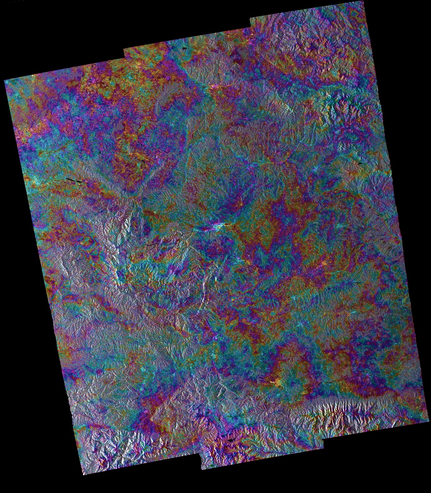
InSAR Data Worth in Groundwater Resource Modeling
In collaboration with Professor Eric Lindsey (UNM EPS), we are exploring the relative worth of InSAR-derived land surface deformation data for groundwater resource modeling. Most of the application of InSAR data in groundwater contexts has been for subsidence monitoring, leaving behind the potentially rich information on storage properties and recharge volumes (otherwise very difficult to estimate for groundwater systems). The challenge is that InSAR data exhibits complex noise that may overwhelm the model inversion process. We are exploring this using simple-complex modeling and ensemble inversion with varying levels of noise complexity.
-
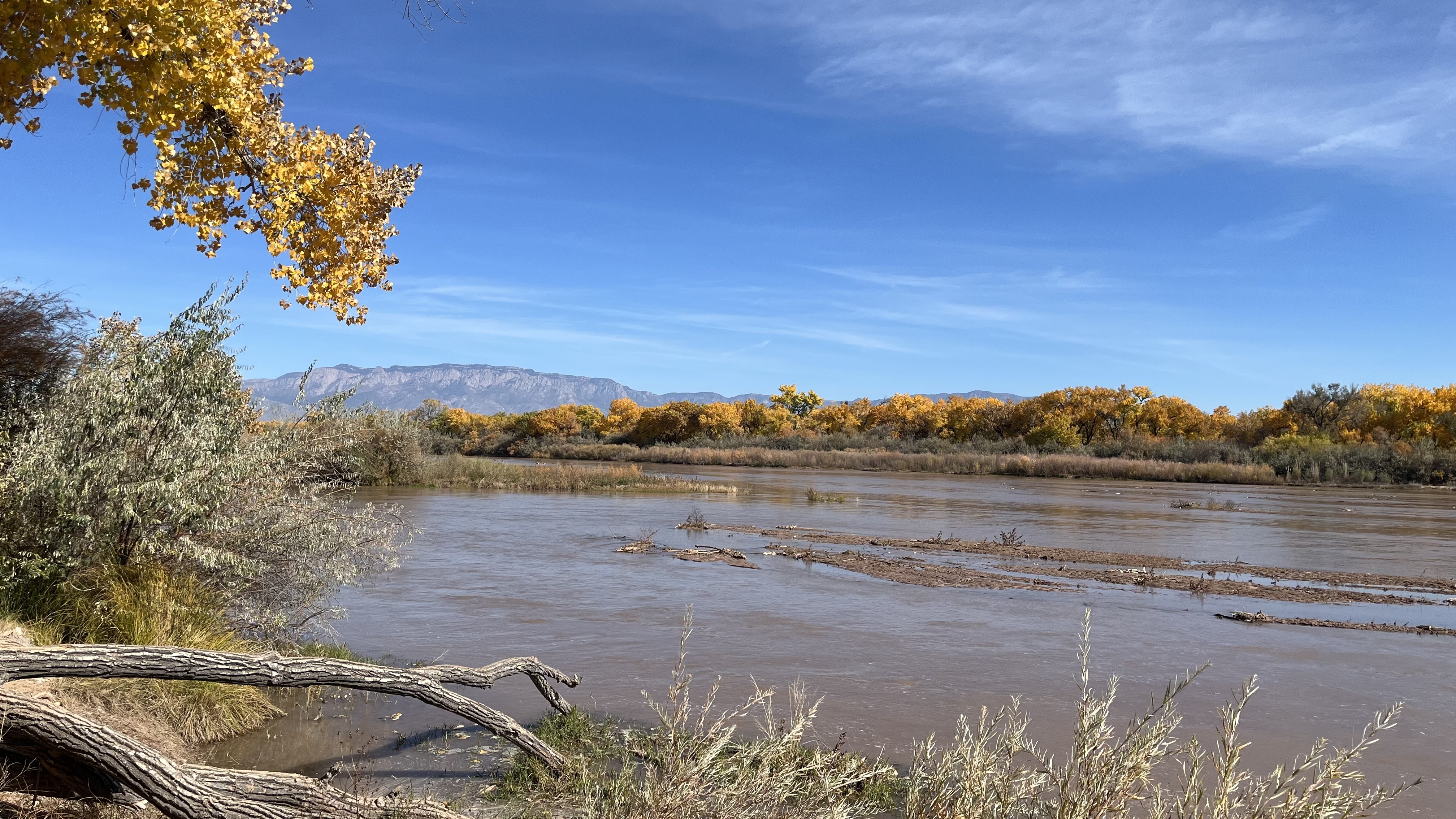
Surface Water-Groundwater Interactions in the Middle Rio Grande Bosque
The shallow aquifer of the Middle Rio Grande Bosque is dynamically connected to the Rio Grande, the interactions of which have been massively altered by digging of drains, construction of Cochiti Dam, and now by drought, climate change, and ecosystem restoration activities. Understanding the current and future behavior of this shallow aquifer is critical for the state as surface water depletions in this region affect our ability to meet interstate compact obligations. We are combining field and modeling approaches to refine our understanding of SW-GW interactions and of the riparian water budget as a whole.
-
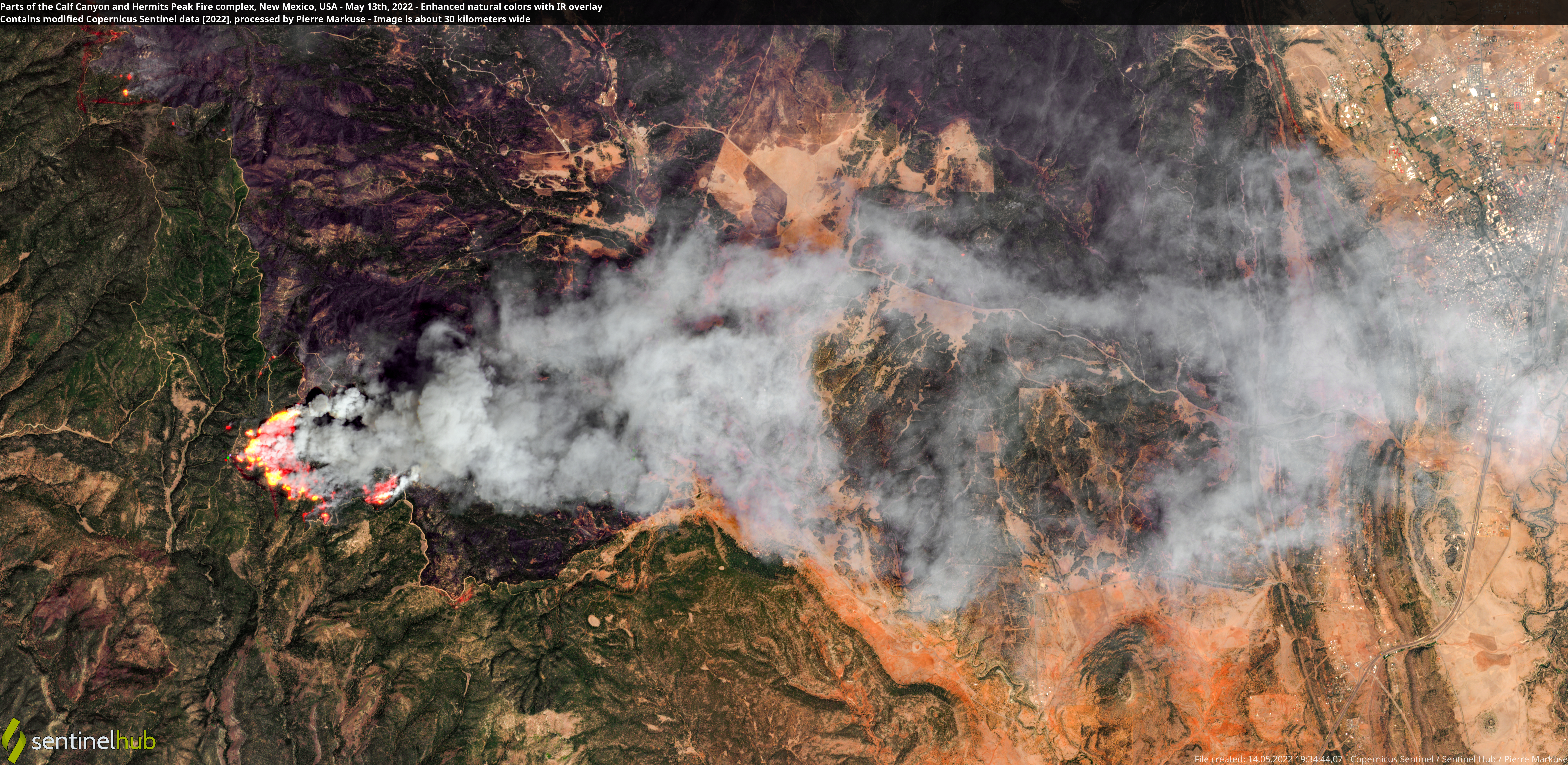
Domestic Well Vulnerability to Wildfire
The 2022 Hermits Peak Calf Canyon fire is the largest in New Mexico history, burning 340,000 acres and impacting rural communities in Mora County. Research on wildfire impacts to hydrology have mainly focused on the more immediate effects to runoff and surface water quality. Recent detections of metals in domestic wells reveal a less studied and less understood risk of wildfire to water resources. This work is merging age tracers with reactive transport modeling to disentangle the (bio)geochemical and hydrogeologic processes producing these water quality impacts.
Publications
Peer-reviewed articles. For a complete list including conference abstracts, see Google Scholar.
2026
-
Multi-Objective Optimization of a Hydro-Economic Model in an Over-Allocated Agricultural Basin
Katherine H. Markovich, Michael N. Fienen, Nicholas Corson-Dosch, Cecile Coulon, Jeremy T. White, Stephen B. Gingerich
Groundwater, 64(3), 278–294
-
Ensemble Methods for History Matching and Uncertainty Quantification With a Watershed Model
Michael N. Fienen, Andrew J. Long, Katherine H. Markovich, Adel E. Haj, Matthew I. Barker
JAWRA Journal of the American Water Resources Association, 62(1), e70086
-
Cecile Coulon, Jeremy White, Katie Markovich, Ahmad Askar, Lakin Beal, Savannah Miller, John Sigda, Annelia Tinklenberg, Cynthia Ardito, Matthew Uliana
Proceedings of the 19th International Conference on Mine Closure (Mine Closure 2026)
2025
-
MF6-ADJ: A Non-Intrusive Adjoint Sensitivity Capability for MODFLOW 6
Mohamed Hayek, Jeremy T. White, Katherine H. Markovich, Joseph D. Hughes, Marsh Lavenue
Groundwater, 63(6), 874–888
-
Jeremy White, Cecile Coulon, Rui Hugman, Katherine Markovich
Mine Water and the Environment, 44(3), 595–607
-
Chandler Noyes, Grant Ferguson, Alan Seltzer, Jessica Ng, Kenneth C. Carroll, Rebecca Tyne, Katherine Markovich, Roland Purtschert, Martin Stute, Jeffrey Severinghaus, Jennifer C. McIntosh
Water Resources Research, 61(8), e2024WR037606
2024
-
Self-Guided Decision Support Groundwater Modelling with Python
Rui T. Hugman, Jeremy T. White, Michael N. Fienen, Brioch Hemmings, Katherine H. Markovich
Journal of Open Source Education, 7(82), 240
-
Jupyter Notebooks for Parameter Estimation, Uncertainty Analysis, and Optimization with PEST++
Chanse Ford, Wonsook Ha, Katherine Markovich, Johanna Zwinger
Groundwater, 62(6), 825–829
2022
-
Katherine H. Markovich, Jeremy T. White, Matthew J. Knowling
Environmental Modelling & Software, 156, 105498
2021
-
Katherine H. Markovich, Laura E. Condon, Kenneth C. Carroll, Roland Purtschert, Jennifer C. McIntosh
Water Resources Research, 57(1), e2020WR027743
2020
-
Sensitivity of Simulated Mountain Block Hydrology to Subsurface Conceptualization
Garrett A. Rapp, Laura E. Condon, Katherine H. Markovich
Water Resources Research, 56(10), e2020WR027714
-
Where Is the Bottom of a Watershed?
Laura E. Condon, Katherine H. Markovich, Christa A. Kelleher, Jeffrey J. McDonnell, Grant Ferguson, Jennifer C. McIntosh
Water Resources Research, 56(3), e2019WR026010
2019
-
Mountain-Block Recharge: A Review of Current Understanding
Katherine H. Markovich, Andrew H. Manning, Laura E. Condon, Jennifer C. McIntosh
Water Resources Research, 55(11), 8278–8304
-
Bayesian hydrograph separation in a minimally gauged alpine volcanic watershed in central Chile
Katherine H. Markovich, Helen E. Dahlke, José Luis Arumí, Reed M. Maxwell, Graham E. Fogg
Journal of Hydrology, 575, 1288–1300
2016
-
Hydrogeological response to climate change in alpine hillslopes
Katherine H. Markovich, Reed M. Maxwell, Graham E. Fogg
Hydrological Processes, 30(18), 3126–3138